3D Map production

Depending on your use and purpose, we will produce colored 3D model of various areas in Japan / the world, mountain, river, landform, landscape, ocean ground, volcano, fault and building.
3D map can be utilized in the broad areas like infrastructure development, natural disaster prevention – preventing frequent flooding etc. –, investigation of natural resources or water resources, tourism development and educational material.

Enlarged 3D map
3D map for Tourism
3D landform map
3D disaster prevention map
3D ocean ground map
3D fault map
3D urban area map
3D building

Jumbo’s 3D map is…

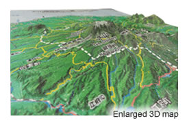
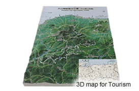
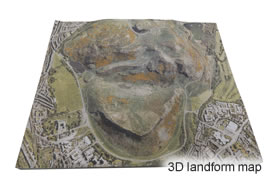
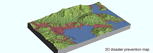
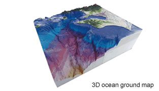
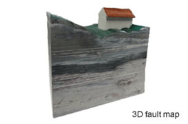
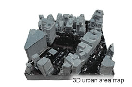
Created by using an electronic topographical map of Geospatial Information Authority of Japan or a satellite image taken by Japan Aerospace Exploration Agency (JAXA)’s PRISM sensor. We will create a 3D map of any land in not only all over Japan, but also all over the world.

Our 3D map is…

  1. Colored 3D production
  2. Low cost
  3. Using safety harmless material (Paper)
  4. Same day or quick delivery
  5. Light and tough paper lamination (Water resistant)
  6. Secured by excellent security system

*We take order from one piece. For large order, we will take order by 3D vacuum forming.

Please utilize a 3D map

You will have a lot of awareness and discoveries from a 3D map. Shifting from a map for looking at to 3D map for using. 3D map will save the time of understanding and thinking all at once.

FAQ on 3D map production
Q1.What is the maximum size to order?
You can order by 250mm x 150mm x 150mm. For the map bigger than this size, we will divide it and print.
*As for the divided map production, there will be a fine dividing line on the connection of each blocks.
Q2.How long will it take for delivery?
Normally, it takes 3 days. It may vary depends on the busyness, finishing and processing method.
Q3.What is the material of 3D map?
It is a layered paper. It is light and strong.
*It will be applied a water-resistant finish with paint or resin film.
Q4.Is it possible to order a colored 3D map?
Yes, we will print in full color.
Q5.Can I order to create a map data?
Yes, we will take an order of the whole process from data creation to color printing and production.
Q6.What kind of data can be used for printing?
We can directly produce a 3D map from STL, obj and VRML data.
3D MAP works by Drone aerophotography